Friday, October 17, 2014

The Hills are Alive!

The second day of our stay in Montrose, after visiting the Black Canyon, we took a drive to Ouray (pronounced "your way").  We drove only a part of the Million Dollar Highway (or Highway 550).
This highway is a spur of Highway 50 that travels from Bernalillo, New Mexico to Montrose, Colorado.  The 25 miles from Ouray to Silverton is referred to as the Million Dollar Highway.  There is a 12-mile stretch that gives the highway its name--this stretch through the Uncompaghre Gorge (through which runs the Uncompaghre River) is challenging and potentially dangerous to drive.  It is characterized by steep cliffs, narrow lanes and a lack of guardrails.

This trip, however, was characterized by the AMAZINGLY, BEAUTIFUL fall-colored, covered hills (honestly, God is such an amazing artist!).  I'm going to show only the colors in this blog and finish off the rest of our trip to Ouray in a second blog. 

I have so many pictures to show you because every turn in the road presented another spectacular view.  I hope you find the breathtaking beauty as spectacular as we did!


The song that comes to mind is "The Hills Are Alive".  Why don't you sing along with me?
 
 
The hills are alive with the sound of music with songs they have sung for a thousand years.
The hills fill my heart with the sound of music; my heart wants to sing every song it hears.
My heart wants to sigh like the chime that flies from a church on a breeze.
My heart wants to beat like the wings of the birds that rise from the lakes to the trees.
To laugh like a brook when it trips and falls over stones on its way. 
To sing through the night like a lark who is learning to pray.
I go to the hills when my heart is lonely; I know I will hear what I've heard before.
My heart will be blessed with the sound of music and I will sing once more.


Isaiah 55:12
For you will go out with joy and be led forth with peace; the mountains and the hills will break forth into shouts of joy before you, and all the trees of the field will clap their hands.

Thursday, October 16, 2014

Black Canyon of the Gunnison National Park

The Black Canyon of the Gunnison is a beautiful and dramatic park where the Gunnison River rushes through the narrow canyon gorge. The steep walls shadow sunlight and the canyon walls appear dark, even black, hence the name. The park itself contains 12 miles of thee 48-mile Gunnison River Canyon. This section is exceptionally deep and narrow.

Rock climbing is one of the premier recreational activities  as climbers relish scaling the gorgeous rock walls that tower above the wild Gunnison River.  The river offers excellent trout fishing and challenging kayaking for advanced paddlers.

There are three drives you can take--the North Rim, the South Rim, and then down into the Canyon and to the River below.  We took the South Rim Road which is a 7-mile drive from Tomichi Point to High Point, and has 12 overlooks.  Most of the overlooks are reached by walking a short trail, and the very good news is that you can take your dogs on all of the trails, but on only three of the hiking trails!  Needless to say, Sadie was a very happy hiker that day!

The drive to Montrose, where we camped at the KOA in town, provided spectacular fall color viewing.


Our drive took us over Monarch Pass which was also another crossing of the Continental Divide for us!  I've actually lost count on how many times we have crossed the Continental Divide.  Up until our travels after retirement, I don't think I had crossed the CD (except in an airplane).  Monarch Pass is 11,312 feet above sea level and, as you can see from the photo below, it was a little bit blustery with light rain and cool temps.
Here we are at the entrance to the National Park.
Our first stop was Tomichi Point which is right at the Visitor's Center. This stop gave us our first view of this magnificent canyon.  It was in the morning so the sun was in front of us.  There really was a small window of time (probably around noonish) that you could get photos from this overlook without the wash-out from the sun.  Since it was our first stop, we didn't get back here until the afternoon and by that time it was a "black-out" because the sun was not reflecting in the canyon at all.
 
The light colored bands in the rock were formed many, many years ago when molten rock was squeezed into fissures in the dark rock.  As the hot fluid slowly cooled and hardened, minerals formed into crystals.  If you look closely, you may recognize flecks of mica, feldspar, quartz, and perhaps even garnet.  These bands of lighter colored igneous rock--called pegmatite dikes--are more resistant to erosion than the dark gneisses (sounds like "nice-es") into which they intrude.  Consequently, the pegmatite weathers more slowly than the gneiss.  The vertical position of the dikes here combined with their resistance to weathering, has produced the fin-like appearance of parts of the canyon walls.  You can see pegmatite at nearly every overlook.
 
I zoomed all the way into the bottom of the canyon where the Gunnison River runs through it.
 
 
Here we are at the overlook.  By the way, the t-shirt I'm wearing is one of my "Home is Where You Park It" t-shirts (I have two in different colors!).
 
Our next stop on the scenic drive was Gunnison Point. This was one of the trails that Sadie was allowed on.  Although the trail went all the way to the campground (located before the Visitor's Center), we only walked to the Visitor's Center (Tomichi Point) and back.  
Here are some of the fabulous views of the canyon from this hike.  Don't you  just love the rock formations?


Swift water of the Gunnison River and abrasion from the sediment it carries are the chief cutting tools in the deepening of Black Canyon, but there are other forces important to the carving of the canyon.  Moisture entering joints and fractures promotes weathering. As the fractures slowly widen, large rock masses are gradually weakened to the point where they slide or tumble to the canyon floor.

This carving process has been slowed by the construction of dams upstream. These dams hold back most of the sediment and most of the peak spring runoff, both of which are necessary for the river to deepen its bed effectively and carry off material eroded from the canyon walls.


Our next stop on the scenic drive was Pulpit Overlook.  From this stop we got a really good glimpse of the Gunnison River and it was only a 1/4 mile hike to the overlook.


In my next blog I'll continue our scenic drive to finish off our one-day trip to the Black Canyon of the Gunnison.  Stay tuned!

Psalms 19:9-11
The fear of the LORD is clean, enduring forever; the judgments of the LORD are true; they are righteous altogether.  They are more desirable than gold, yes, than much fine gold; sweeter also than honey and the drippings of the honeycomb. Moreover, by them Your servant is warned; in keeping them there is great reward.

Wednesday, October 1, 2014

The Wild West

Wild Basin is a scenic trail, the southeastern entrance into Rocky Mountain National Park and the less traveled area of the park compared to its northern counterparts. That doesn't mean the beauty isn't there--here we had the opportunity to witness some of the best and most  pristine scenery the National Park has to offer although we had to work a little harder to get there!
A dirt road leads to a ranger station, parking and horseback or hiking trails.  It was from this eastern side of the park that we had a great hike up to Copeland Falls and then further up to Calypso Cascades (see one-way miles below).  The Wild Basin Trailhead also leads to a number of lakes (some as far away as an 8-mile hike) in the area.  The last lake on the hike, Snowbank Lake, has a 3,021 foot gain in elevation, and remember you're starting at 8,500 foot elevation.  Do I need to really tell you we didn't do that???
 
It's a short hike up to Copeland Falls, but you're walking along Cony Creek (which is catch and release only) the whole way and you know how much I love the sound of water rushing so it made our whole hike so very pleasant.  
As I mentioned earlier, you drive in on a dirt road to get to the trailhead.
Here's Gary at the beginning of the trail.  Doesn't he look like a happy hiker?  I think he kinda looks like a sourpuss in this photo.  He sometimes gets annoyed with me for wanting to take his pic ... I say, "Just deal with it, okay?"
Our short hike reaped great reward with Copeland Falls.  Not exactly the tallest waterfall (is that an under-exaggeration if you've ever heard one before?), but it was a pretty site.  These are the lower falls (which indicates there are upper falls as well).
 
And here are the upper Copeland Falls.
 
It was a rigorous last 1.5 miles up to Calypso Cascades but once again so worth the hike and the great outdoor exercise! Here's a view of our trail.
And now for the tumbling Calypso Cascades ... so beautiful!
 
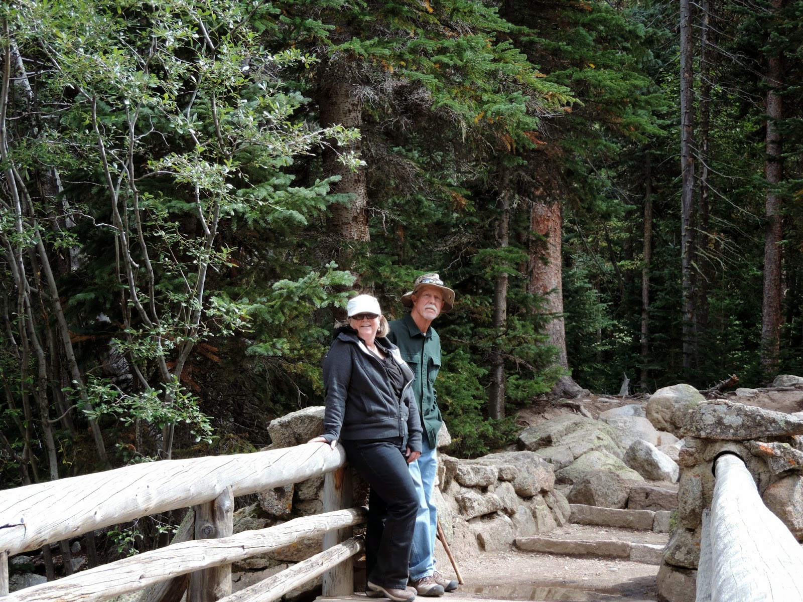
This bridge crosses the creek right at the Cascades and provided a perfect photo opp!
And to top it all off, how about some sound affects with that water?  I couldn't resist videoing the falls so you could experience the lullaby sounds of the rushing waters.  Sorry it's sideways ... how easily I forgot that I can't do portrait with video and need to stick with landscape!  I hope you enjoy the sounds of many waters like I do!
This blog ends our Rocky Mountain High experience.  Next up?  Black Canyon of the Gunnison National Park and the beautiful mountain-surrounded town of Ouray (pronounced Your-way) where the Fall colors were splashed all over the mountainsides.

Psalms 93:4
More than the sounds of many waters, than the mighty breakers of the sea, 
the LORD  on high is mighty.