Saturday, September 27, 2014

Lily Lake

Water Lilies
by:  Sara Teasdale

If you have forgotten water lilies floating
On a dark lake among mountains in the afternoon shade,
If you have forgotten their wet, sleepy fragrance,
Then you can return and not be afraid.

But if you remember, then turn away forever
To the plains and the prairies where pools are far apart,
There you will not come at dusk on closing water lilies,
And the shadow of mountains will not fall on your heart.

In actuality, this poem should have accompanied my post on Nymph Lake which was filled with flourishing, floating water lilies.  However, the pictures below are of Lily Lake and to be perfectly honest I don't remember seeing even one water lily resting recklessly on Lily Lake!

Lily Lake is located just barely inside RMNP--the park boundary juts out to the east to lasso this little lake into the park proper.

I had to take a picture of this sign on behalf of Sadie who sat out this adventure--and everyone of our other hiking adventures in RMNP--in the car.  For the most part, national parks do not allow dogs on trails, although fairly soon I'll tell you about our first exception to that rule.
This view from the lakeshore at 8,927 ft. is of Estes Cone whose peak spires at 11,006 ft.  There's actually a 7.6 mile trail from Lily Lake to Estes Cone which is frequented by hikers, and we weren't counted as one of the members of that elite fitness faction!
 
We did, however, take the 1/2 mile stroll around the lake and took these photos.
 
 
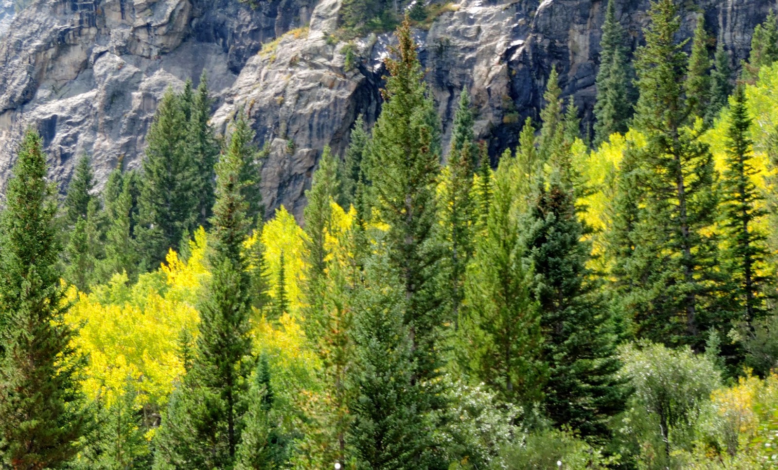
Here's a shot of our shady, flat trail.
 
The wildlife--in abundance!
 
Back to the campground--here is a photo of our campsite right outside RMNP.  We stayed two days at Moraine Campground in RMNP and then stayed at Spruce Lake Campground (below) in Estes Park (located just 15 miles from our campground in RMNP) for three days--full hook-ups you know ... gotta have 'em!
 This is a view of the Rocky Mountains from the campground.
Here are some photos in the campground after it snowed.


Psalms 147:16-20
He gives snow like wool; He scatters the frost like ashes. He casts forth His ice as fragments; who can stand before His cold? He sends forth His word and melts them; He causes His wind to blow and the waters to flow. He declares His words to Jacob, His statutes and His ordinances to Israel. He has not dealt thus with any nation; and as for His ordinances, they have not known them. 
Praise the LORD!

Trail Ridge Road

Trail Ridge Road (Hwy. 34) is considered RMNP's highway to the sky and is the most heavily traveled road in the park.  It covers 48 miles from the east side of RMNP to the west side past Grand Lake, Shadow Mountain Lake, Lake Granby and then exits at the southwest end of the park. Eleven of the miles are traveled above the treeline where the park's evergreen trees come to a halt.

The drive begins in a forest of aspen and ponderosa pine, enters thick alpine forests of fir and spruce, and then at the treeline the last stunted wind-battered trees yield to the alpine tundra.  From the many pullovers you get extravagant views that sweep north to Wyoming, east across the Front Range cities and Great Plains, south and west into the heart of the Rockies. The Continental Divide, where streamflows are separated east from west, is crossed at Milner Pass located at 10,120 ft. elevation which is located west of the highest point on the road ... and we didn't get that far in our drive.

We traveled part of the road twice during our stay.  The first time was before the snow and we stopped at a number of the overlooks on the way.  The road's highest point is between Iceberg Pass and Gore Range and is 12,183 ft. in elevation.  The furthest we went on this road was Forest Canyon Overlook at 11,716 ft. in elevation--east of the Continental Divide.

Here are some pictures we took on our way to those higher elevations.


Below, a little relaxation and time out of the car on the way!
 
Our first stop on the way up was at the first overlook, Many Curves Overlook.  Below is a video that pans the beautiful view from this first overlook.
This first photo was taken from the Rainbow Curve Overlook at 10,825 ft., still below the tundra, but a beautiful day as you can see!
Here's a video panning the view from Rainbow Curve Overlook.
Next stop, Forest Canyon Overlook at 11,716 ft.   In a couple of these photos you get a good look at the alpine tundra (photos #1 and #3 below).  You can also see it's much cloudier up here and the weather is starting to turn a little.  It was very windy and we didn't stay long because the wind was a might chilly as well as stiff.
 
 
Our second excursion up Trail Ridge Road was the day after we had snow.  I thought we'd see so much snow on the ground, but how wrong a girl can be!  There was snow, but not blanketing the ground, just whispers of it.


Exodus 34:5-7
And the LORD descended in the cloud and stood there with him as he called upon the name of the LORD. Then the LORD passed by in front of him and proclaimed, "The LORD, the LORD God, compassionate and gracious, slow to anger, and abounding in lovingkindness and truth; who keeps lovingkindness for thousands, who forgives iniquity, transgression and sin; yet He will by no means leave the guilty unpunished, visiting the iniquity of fathers on the children and on the grandchildren to the third and fourth generations."

Sunday, September 21, 2014

Butt-Kickin' Time

This was our third attempt to get to Bear Lake.  Weather was an issue the other two times and we turned around.  This was it ... either we ignored the weather and went on the hike or we would have to forget about Bear Lake.  But we'd heard it was really pretty so were committed this time ... and you've heard it said many times before, "Third time's a charm" and it was for us!   It is one of the top five places to visit in RMNP and thus a very popular destination including a very crowded parking lot.  We were so thankful to get a good parking space after circling it 2-3 times hoping for one.  Since we had Sadie with us, it was important that we got a parking space in this lot and not one where we had to take a shuttle.

Bear Lake was formed during the ice age by a glacier. Sitting at an elevation of 9,450 feet the .8 mile hike circles around the subalpine lake as it passes through a forest of spruce, fir, lodgepole pine and aspen. Many of the lodgepole pines in this area are in the process of dying, or are already dead.  This is a result of the mountain pine beetle infestation that's had a profound impact on forests throughout the Rocky Mountains.

Near the beginning of the loop, along the eastern shore of the lake, you have a commanding view of Hallett Peak.  As you proceed along to the north side of the lake you'll have a spectacular view of Half Mountain and Longs Peak.

The weather was a little "punky" but we headed out for a beautiful hike around Bear Lake (we circled it twice).  As you can see from the photos below (from the choppy lake surface) it was a bit windy but that didn't distract from the beautiful mountain views.


Along the path were a number of benches that provided not only many occasions to sit and gaze upon the beautiful, serene scenery, but (in our case) also provided great photo opportunities. 
The fall colors were starting to explode on the hillsides as the aspens were beginning to bathe themselves in burgundy and golden hues.
 
By the time we were finishing our second loop around this beautiful alpine lake, the wind had subsided and the surface of the lake started to look glassy providing some lovely lake reflections.
 
 
Before leaving the trail I got a picture of John Muir ... uh, I mean Gary Robert Brooke fancying himself as John Muir :)
Wildlife also decided to join in the adventure and we saw a number of large blue jays hanging around in the tree branches lakeside.
When we finished that relatively easy 1.6 miles we decided to take the .5 mile hike to Nymph Lake. Hey, it's only 1 mile round trip ... we can do that!  Unfortunately, what we didn't know before starting the hike was it going to be a 225' elevation gain in just 1/2 mile.  Boy-oh-boy did I get a cardio (on the way up) and quad (on the way down) workout!  It was straight uphill without and flat areas to give you a rest, although we had to stop a number of times for me to catch my breath and give my heart rate a rest.  Remember we started out at over 9,400 feet!

Waterlilies grace the surface of this deep blue lake and rising above it are Longs Peak, Flattop Mountain and Hallett Peak (which you really can't see in most of these photos--except the last one--due to the clouds and glare).  In the second picture below, however, you can see some of the devastation that the mountain pine beetle is causing.


And there's more wildlife!  Right as we were leaving the ranger station area heading back to the parking lot, the Jeep, and Sadie (who was patiently waiting inside the car for us--dogs are not allowed on any trail in any national park), there's a moose hanging around in the brush enjoying a nice midday snack!  She had quite a group of photographers and tourists gawking who were delighted by her nearness to the sidewalk (including us!).

Luke 8:24-25
They came to Jesus and woke Him up, saying, " Master, Master, we are perishing!" And He got up and rebuked the wind and the surging waves, and they stopped, and it became calm.  And He said to them, "Where is your faith?" They were fearful and amazed, saying to one another, "Who then is this, that He commands even the winds and the water, and they obey Him?"

A great way to start our hiking routine ... Alberta Falls

I'm saying it's a great way because it was only a 200' elevation gain throughout the .7 mile one-way hike to the falls.  This will mean so much more to you later when I tell about the other hikes we took in RMNP.

The falls were a beautiful, worthwhile trip and it was an easy hike to see such grandeur.  The falls were named after Alberta Sprague the wife of Abner Sprague, one of the original settlers in the Estes Park area.  Abner was also the first person to pay a fee in as a visitor to enter Rocky Mountain National Park in 1939.  The name "Sprague" should be familiar since we also hiked around Sprague Lake earlier in the week.
 
Here's Gary standing closer to the top of the falls.  I was actually quite a ways away from him when I took this photo but eventually joined him, carefully stepping over the rocks and ridges to get up on that rock outcropping.
 
 
This is Glacier Creek which Alberta Falls flows into.  This was taken on our hike back.  You can see the fall colors just starting to turn along the creek.
 
This one-sided bridge crosses Chaos Creek at the beginning of the trail.  You can see the trail meandering off to the left.
 
From Alberta Falls we headed back to Trail Ridge Road and Horseshoe Park.  From a turn-out you get these spectacular views of this expansive part of the park.  Our time in Colorado has been filled with these beautiful azure skies and puffy white cotton clouds. 

The three peaks below are (from left to right) Mount Chiquita (13,068'), Ypsilon Mountain (13,514'), and Fairchild Mountain (13,502').  The lighter green patch on the mountain right in the middle of the photo is an alluvial fan which you can see a little better in the next photo (the second picture I zoomed in on the mountains).  The road to this area was closed due to flood damage last year.
 
Why is the park called Horseshoe?  You'll see why below!  The Fall River meanders through the park creating these oxbow curves which is why they think settlers may have named the park Horseshoe.
 

Psalms 147:10-11
He does not delight in the strength of the horse; He does not take pleasure in the legs of a man.  The LORD  favors those who fear Him,  Those who wait for His lovingkindness.