The Ring of Fire is an area in the basin of the Pacific Ocean where a large number of earthquakes and volcanic eruptions occur. In a 25,000 mile horseshoe shape, it is associated with a nearly continuous series of oceanic trenches, volcanic arcs and volcanic belts and/or plate movements. It has 452 volcanoes and is home to over 75% of the world's active and dormant volcanoes. The Ring of Fire is sometimes called the circum-Pacific belt. About 90% of the world's earthquakes and 81% of the world's largest earthquakes occur along the Ring of Fire. How do you like that, you Californians?Things were looking promising when we had a couple of wildlife sighting at Logan's Pass. The first thing we saw (which was across from the parking lot and up the hillside) was a small herd of bighorn sheep.
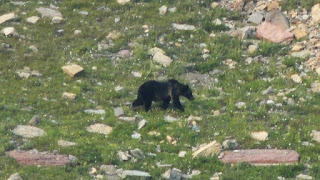
But the big "bonanza" was the bear!!
Colette took a video of the bear strolling towards one of the hiking paths ... eek!!! By the way, I know the possibility exists that the video will not play so I'm also going to post it on my FB page and hope it works there.
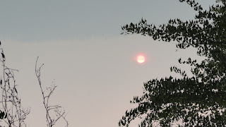
But as I mentioned, the smoke was obnoxious and the burn was terrible. The next two photos were taken at Lake McDonald and you can see how much the sun is being filtered by the smoke.
I zoomed in on the sun because you couldn't see how red it really was from the previous photos. The zoomed-in one (below) really shows how much the smoke altered the look of the sun.
This is a shot of the burn area on the east side of the park, near Lake St. Mary. The landscape on the east side of the park has been radically revised. In reading the local newspaper, they brought in the "silver lining" to all of this ... with the clearing of trees the views of the mountains are now magnificent because now you can see them! Who said you can't find something good in a bad situation? Shame on them!
And now, what you've all been waiting for ... our grand exit and then entrance ...
Along our route to Waterton Glacier International Peace Park, we entered ...
And, just in case you didn't really see a bear, they had these lovely roadside stand-ups for photo opportunities ... eek!!! Below, Gary and me caught by surprise (ha!ha!).
Here's our good friends, Joe and Colette. We are sure going to miss them after we depart, but we just might see them again next summer in Colorado! This bear did not give them a fright ... what's wrong with them?
We thought we weren't going to see any wildlife, but silly us. How about these "Glacier Buffalos" (as we so cleverly called them since we were desperate for any wildlife sighting in Canada) that were scattered throughout the route?
Our first destination was Red Rock Canyon. The Red Rock Parkway travels 5 km up the Blakiston Valley through rolling grasslands and ends at Red Rock Canyon. It is considered the best place to experience Waterton's classic prairie-meeting-mountain landscape (which had significantly diminished views by all the smoke in the air). At the end of the parkway we took a short self-guided trail that looped around the canyon.
Smoky, smoky, smoky :(
In this photo you can really see how smoky it is in the area from all the wildfires. Canada also had its share of fires this summer.
Looking straight down into the canyon from the hiking trail.
These are mud cracks along the interpretative trail. When ancient sea waters subsided, mudflats were left to dry out and crack. As the water returned, the cracks filled up with slightly different deposits. Later hardening to rock, the honeycomb pattern on this footpath was created.
Leaving Red Rock Canyon we decided to explore Waterton Village (located on Upper Lake Waterton) and stumbled across Cameron Falls. But first, a little bit of this quaint town situated in the middle of Waterton National Park ...
Gary rockin' it!
A shot of this town. That's Joe, Gary and Colette strollin' down the street.
More of Main Street
And now, Cameron Falls ... These falls cascade over ancient dolomitic rocks.
Sadly, I "lost" a number of photos I took today. I don't know what I did, but some fancy finger work did the trick and they are no longer ... not even in my "trash" ... so sad :( So, that's all for the day although it wasn't all for the day!
Micah 1:3-4
Look! The LORD is coming from His dwelling place; He comes down and treads on the heights of the earth. The mountains melt beneath him and the valleys split apart, like wax before the fire, like water rushing down a slope.


No comments:
Post a Comment