But, we saw such beauty all around us in this part of Oregon and in the next few blogs you are going to see just what we mean.

National Creek Falls occur where the spring-fed creek diverges around a basalt outcropping and plunges about 40 fee over a jagged ledge in two scenic channels. The grotto below the falls is exceptionally scenic and thriving in greenery, with a small meadow of mosses growing on a flat area just downstream of the falls where Falls Creek merges with National Creek. The falls flow very consistently and are good to visit anytime of the year.


But, alas, we never found our way to the lookout although we did see it from a distance.

We drove and drove and drove and then decided, "We're lost!" so we turned around. It wasn't a complete loss, however. We did get to see Rabbit Ears. Rabbit Ears is an unusual rock formation nestled in the tree rises over 5,800 feet from the valley floor. The peaks located in the Rogue River National Forest are a remnant of the core of an ancient volcano.

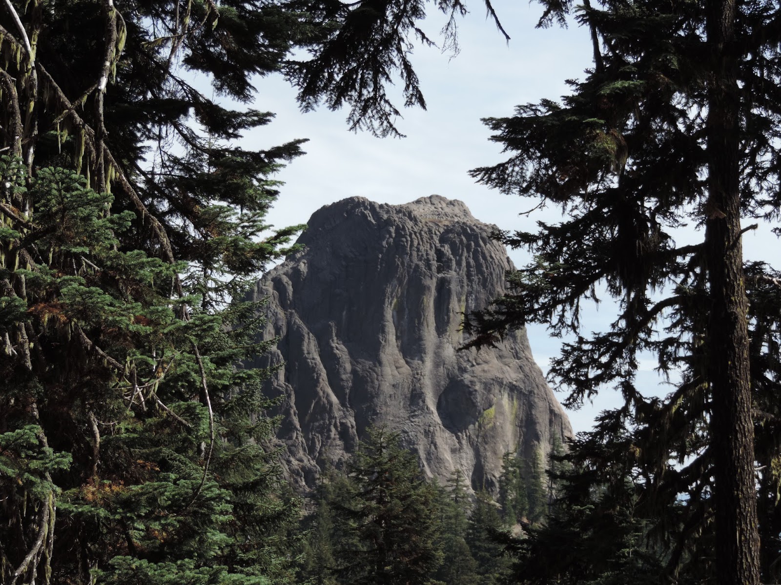
In the photo below you can see both peaks, thus the name "Rabbit Ears."

Some miscellaneous flora and fauna along our meandering, wandering road.


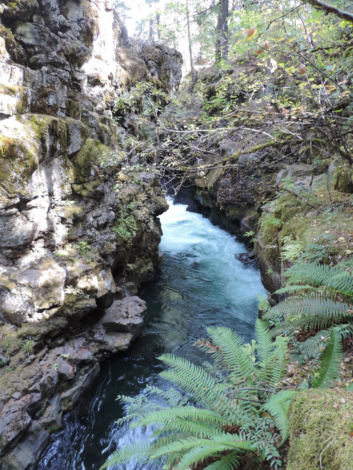
The Rogue Gorge forms a chasm 500 feet long. The Gorge narrows to 25 feet from the platform's edge to the opposite wall, and it drops 45 feet to the river.

The water remains a steady has an average temperature of 44 degrees. Because of this very cold water, native fish do not grow to a large size.


As much as I tried to really get a good picture of the lava tubes on the river, it just didn't work out all that well, but I'm still including them here. Just use your imagination! This next photo explains how lava tubes are formed and what you should look for (although that really isn't going to help ... sorry!).

Close-ups of a lava tube.


There are lava tubes in the next three photos in case you want to know.


This is water rushing out of a lava tube.

Now we're back to plain old Rogue River Gorge photos.


At an overlook on the Gorge.


Going into the lava tube.

And this is where the water comes out at the other end.

Just some stuff that I liked on the trails along the Rogue River Gorge.


A final farewell glimpse of the Rogue River Gorge.

Isaiah 46:18
If only you had paid attention to My commandments! Then your well-being would have been like a river, and your righteousness like the waves of the sea.
No comments:
Post a Comment