This second excursion into Joshua Tree NP (on a Saturday) we stayed on the main road, Park Boulevard, which took us through the Mojave Desert side of the park. This is really the more scenic side and it is where the majority of the Joshua Trees reside.


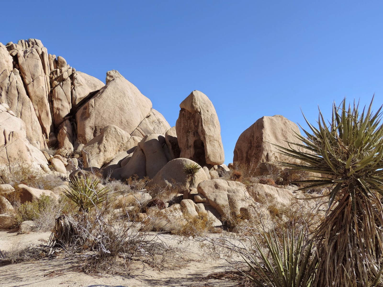
Our first stop in the park was at Split Rock. You can't imagine what we found there. Yup, that's right. A split rock! There's a 2-mile trail here which we will come back to on another visit.

Not only is there a split rock at Split Rock, but there's also some more amazing rock jumbles.


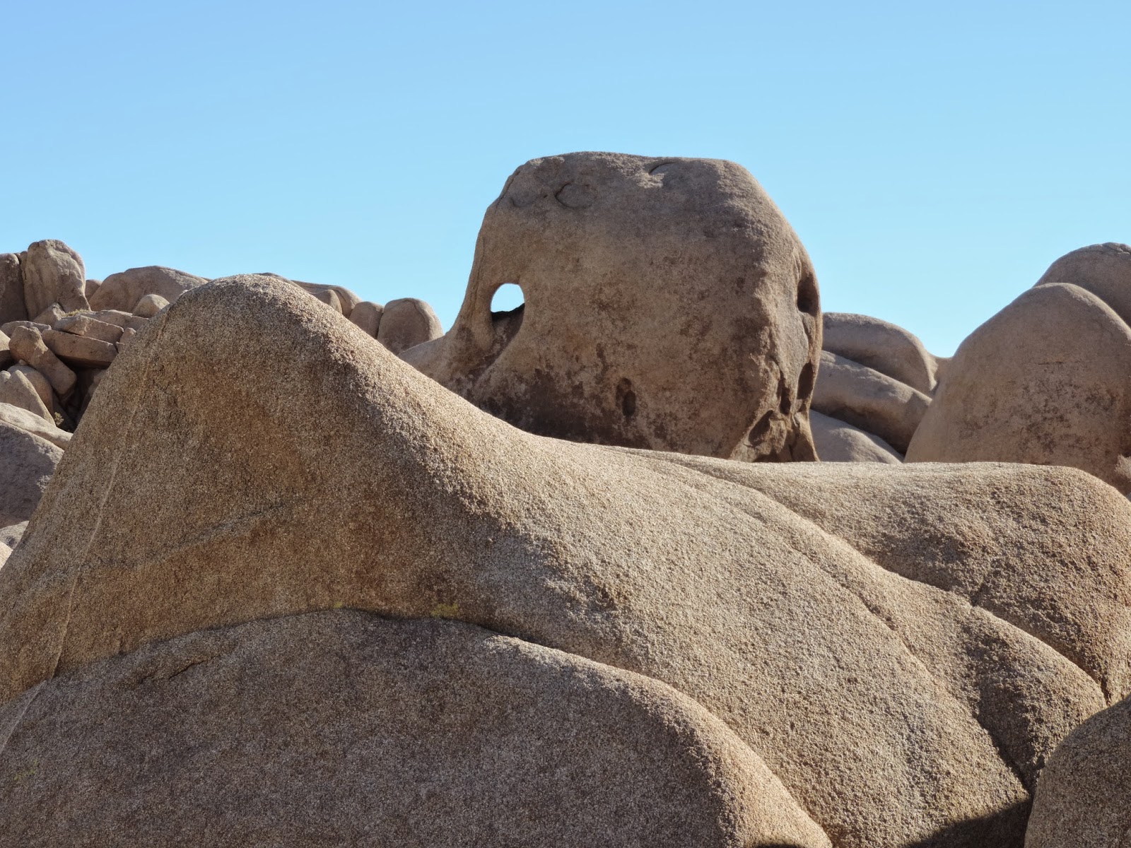
And, how about this ... a window! Do you remember that from Arches?

Here I am doing my best to push the rocks over. Sadie isn't being much help.
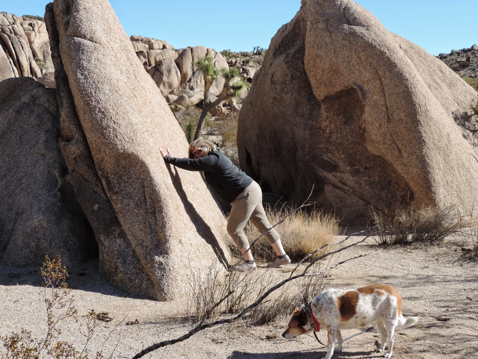
Here's Gary and Sadie.

This Joshua tree probably died from laziness :), or maybe too much sunbathing?

Our next stop was Skull Rock Trail. And, what did we find there? Yup, that's right ... a rock that looks like a skull! You're getting good at this! Now, I hate to have to "tell all", but the truth is we didn't see Skull Rock until after we completed the 1.7 mile roundtrip hike to the campground and back! Near the end of the hike we kept looking around and commenting on how we hadn't seen anything that remotely resembled a skull. We were at our car across the street from the trailhead and the very visible Skull Rock sign (I might add) when I turned around and said, "Uh, oh ... look at that! There's Skull Rock!" It was visible from the street and we just totally missed it! When I went back to get those all important photos, there was a young woman there by herself and she asked me to take her picture ... but she had specific instructions. She wanted a picture of herself picking the skull's nose! Who'd a thunk it?

Here are some photos from our hike on the trail.

Another "split rock".

Holy hill, Batman!

We got back in the car and decided to take Geology Tour Road, an 18-mile loop on an unpaved road. I personally was hoping to see some wildlife since we would be off the beaten path, but that wish was left unfulfilled. There were a number of these rocky outcroppings that just popped up out of the ground.

One of the "stops" was at Squaw Tank. Really, it wasn't much to look at, but it does have some history associated with it. Cattlemen built such dams to catch runoff water for their cattle during the early 1900s. Many of these dams are located where water collected in natural "tanks" or pools after rains. Notice the balanced rock?

Here's Gary standing on top of the tank, to the right of it.

And here are some awesome rock formations located at Squaw Tank.


Erosion over the ages has stripped the overlying Pinto gneiss (do you word from our trip to The Black Canyon of the Gunnison NP?) exposing the monzogranite outcrops as you see them in my photos. Long exposure to weathering has removed rubble from vertical rock sections leaving steep-sided boulders above the surrounding landscape.

About half-way through the loop, we stopped and pulled into a parking slot on the side of the road to eat lunch (in the car). From that vantage point, we had an excellent view of the wispy, pencil-thin line of a road that was our road in and out of this 18-mile side trip.

By now you know how much I love the rock formations in the park. I kept telling Gary how so much it would be like Utah if they were colored red like Arches and the rest! Look at the way this slab is teetering on top of the boulder ...

And how about this HUGE boulder balancing on top of those smaller blocks...

Joshua trees and rock outcroppings ... a great combination! The landscape in Joshua Tree NP is the product of at least two widely separated episodes of mountain building. The latest of these episodes was followed by uplift and very deep erosion and then by further uneven uplift along faults. Erosion exposed two rock bodies originally formed deep below the earth's surface.
Many other geologic events occurred in this area, however the rock record has been lost through erosion. What remains are primarily the roots of old and very ancient mountains. The rocks that we see in the park have been faulted, jointed, weathered, and eroded to produce the geologic scenery of Joshua Tree NP.

Another balanced rock ...

Okay, I really liked this one. It looks like the two rocks broke apart. There are a number of faults in this area which all have had (and will continue to have) a big impact on its current and future formation.

Our last stop was Barker Dam that included a 1.1 mile loop trail. We were ready! One of the things I really like about Joshua Tree NP is the number of "shorter" hikes/nature trails within the park. There are 11 short hikes/nature trails ranging from 1/4 mile to 1.7 miles long. Also, 35 miles of the California Hiking and Biking trail traverses through the park. They say to allow 2-3 days to hike the whole trail.
Here's the start of our Barker Dam trek ...

Check out the nasty thorns on this cactus ...

Here is Barker Dam. You can see how high the water gets in peak seasons. The drought has this watering hole at a scummy low level.

This is a cistern that was down the hill a little ways to the left of the dam (above).

On the way back, we took a very, very short side trip to see these petroglyphs.


More weathered rocks and stately Joshua trees.

And we got to see some wildlife! A small bird. There were about 8-10 of them scrounging around on the ground and I was lucky enough to get a photo since they were scurrying around. I've tried (unsuccessfully) to discover what type of bird this is; however, one of my blog readers (Zonia) identified it for me! It is a Cassiar Junco, a bird native to North America.

Psalm 50:11-12 & 15
"I know every bird of the mountains, and everything that moves in the field is Mine. If I were hungry I would not tell you, for the world is Mine, and all it contains ... Call upon Me in the day of trouble;
I shall rescue you, and you will honor Me."
"I know every bird of the mountains, and everything that moves in the field is Mine. If I were hungry I would not tell you, for the world is Mine, and all it contains ... Call upon Me in the day of trouble;
I shall rescue you, and you will honor Me."
No comments:
Post a Comment